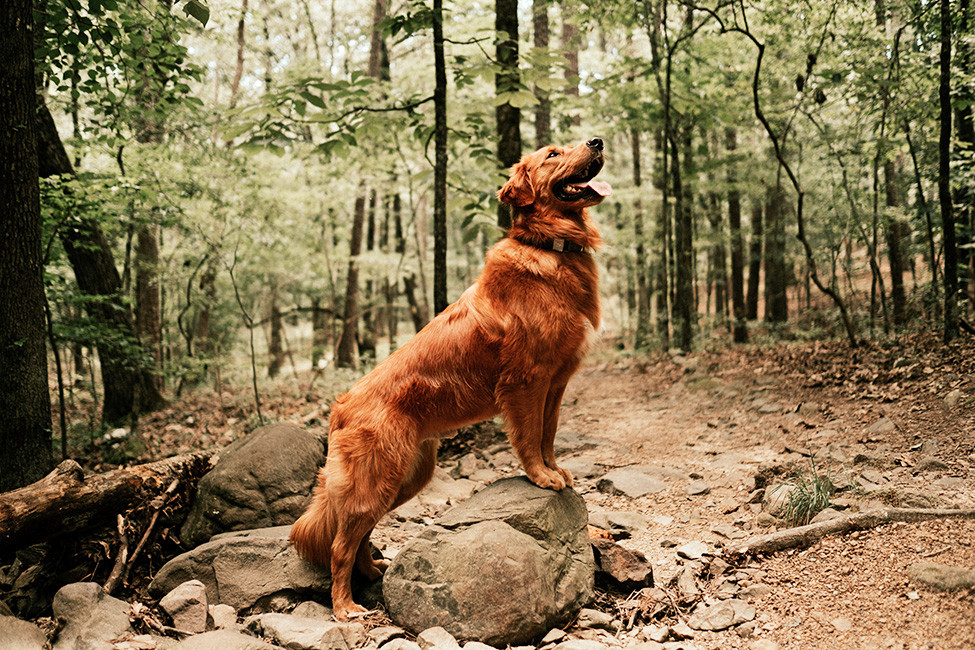
Great Outdoors: Play in Your New Metro Little Rock Backyard

Metro Little Rock is a true hidden gem for so many reasons, but the area’s natural beauty and plentiful ways to immerse yourself in it is by far our crown jewel.
Pinnacle Mountain State Park
Hiking up to the top of Pinnacle Mountain is a rite of passage for any newcomer to central Arkansas. Hikers have the option to choose the “hard” or “easy” side of the mountain, but both routes offer sweeping views of the Arkansas River Valley and the Little Rock skyline.
Elevation: 1,011 feet | Distance from Little Rock: 17.2 miles (24 minutes)
Two Rivers Park

Located along the Arkansas River Trail System, Two Rivers Park is a hotspot for bikers, runners, birdwatchers, fishing enthusiasts and horseback riders alike. The park offers 450 acres of mostly wooded wetlands and 550 acres of open fields, making it the most natural portion of the River Trail. Deer can be spotted grazing year-round.

Bridge trivia: Most of the pedestrian bridges along the Arkansas River Trail are re-purposed railway bridges. Little Rock has invested millions of dollars into the bridge system, including The Two Rivers Bridge that was built from scratch costing $5.3 million.
The Big Dam Bridge
Also located along the Arkansas River Trail System, the Big Dam Bridge is another one of those Little Rock bucket list destinations. Those that make the trek across the bridge will be rewarded with unique views of the river valley, Pinnacle Mountain, Two Rivers Park and Emerald Park.
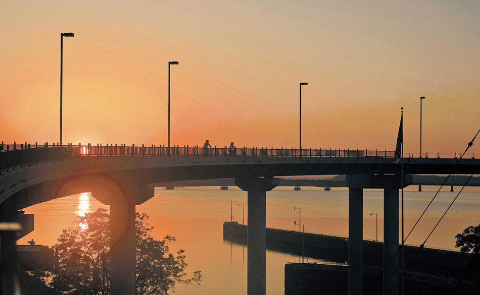
Length of the bridge: 4,226 feet
Fun fact: The Big Dam Bridge is the longest pedestrian and bicycle bridge in North America, built specifically for that use.
Allsopp Park
Allsopp Park is the perfect spot to get lost in nature without leaving the city. The park’s entrance is located off of Cedar Hill Road in the Riverdale neighborhood and stretches west up to Kavanaugh Boulevard, connecting it with The Heights and Hillcrest. The park itself encompasses over 150 acres and has endless recreational opportunities from trail running to basketball. In the fall, the colorful foliage is simply breathtaking.
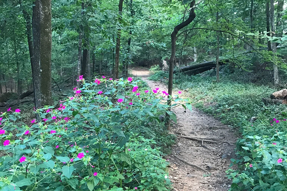
Miles of trails: 3.7
Fun fact: Allsopp Park was opened to the public in 1931.
Burns Park

Burns Park is a sprawling oasis covering 1,700-acres, which makes it Arkansas’s largest urban municipal park. The park offers two 18-hole disc golf courses, two golf courses, a dog park, a baseball and a softball complex, Bonzai BMX track, a soccer complex, a tennis center, playgrounds and camping, an archery range, and trails with access to the Arkansas River Trail. (PDF)
Popular trail: The Burns Park MTB (mountain biking) loop is a 7.3 mile stretch of the park that’s also dog-friendly (as long as your four-legged friend is kept on a leash).
Little-known fact: Burns Park is also home to a pre-Civil War log cabin.
Emerald Park
This park in North Little Rock features the Emerald Park Trail, which winds along the bluff line above the Arkansas River. Hikers will be treated to sweeping views of the river valley and the Little Rock skyline.
Elevation gain: 554 feet | Trail distance: 5.3 miles round trip
ENJOY CENTRAL ARKANSAS BY ...
Boat:
Kayaking
Rock Town River Outfitters offers kayaking tours along the Arkansas River starting at just $45 for two hours.
Sailing
Grande Maumelle Sailing Club is a nonprofit company in the metro that teaches adults and kids how to sail. After mastering this sport, you can compete in a number of sailboat races throughout the year.
Bike:
Arkansas River Trail System
The most beloved bike trail in central Arkansas has to be the Arkansas River Trail System. The trail winds for 88 miles through Little Rock, North Little Rock, Maumelle and Conway. This biker’s paradise is highly trafficked and family friendly, with plenty of pretty areas to stop and admire the views.
Foot:
Rock Creek Trail
Big fan of cross-country running? This trail is the perfect spot to run a quick 5K while surrounded by nature. The trailhead is located at 200 N. Bowman Road. It's not as highly trafficked as some, so we’d recommend adventuring with a buddy.
Lake Willastein
This 2.1 mile walking trail in Maumelle winds around the picture-perfect lake and park area. Kids especially love the playground and pointing out the ducks that frequent the lake.
T.R. Pugh Memorial Park
This North Little Rock park is home to the iconic Old Mill, which was featured in the opening scene of “Gone With the Wind.” Be sure to bring your camera for the abundant photo ops.
Horse:
Burns Park and Two Rivers Park
You can take your equine friends along with you on designated horseback riding trails in Burns Park in North Little Rock and in Two Rivers Park in Little Rock. Horse trailer parking is located on Joe K. Poch Road in North Little Rock and between the public gardens and the restrooms at Two Rivers Park off of Pinnacle Valley Road in West Little Rock.
Mat:
Yoga in the Rock
Yoga in the Rock offers yoga with a view at different outdoor spots around the city. From April to October each year, the group offers free yoga classes perfect for beginners or more practice for serious yogis. For more info, find Yoga in the Rock on Facebook.
BRANCHING OUT
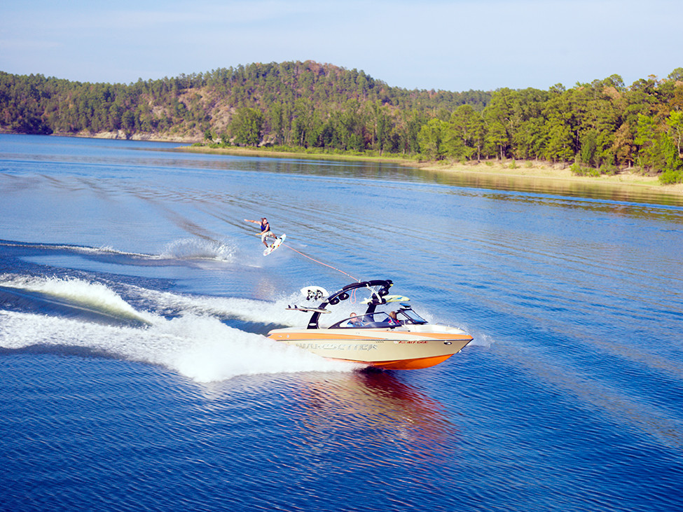
Spend Weekends at the Lake
Just 50 minutes southwest of the metro, Hot Springs is home to five lakes — Lake Catherine, DeGray Lake, Lake Greeson, Lake Hamilton and Lake Ouachita. Hot Springs, also known as the Spa City, is the place to be during the dog days of Arkansas’ summers and a favorite among boaters near and far. So is the popular lake town of Heber Springs, which is situated on beautiful Greers Ferry Lake about 90 minutes north of downtown Little Rock.
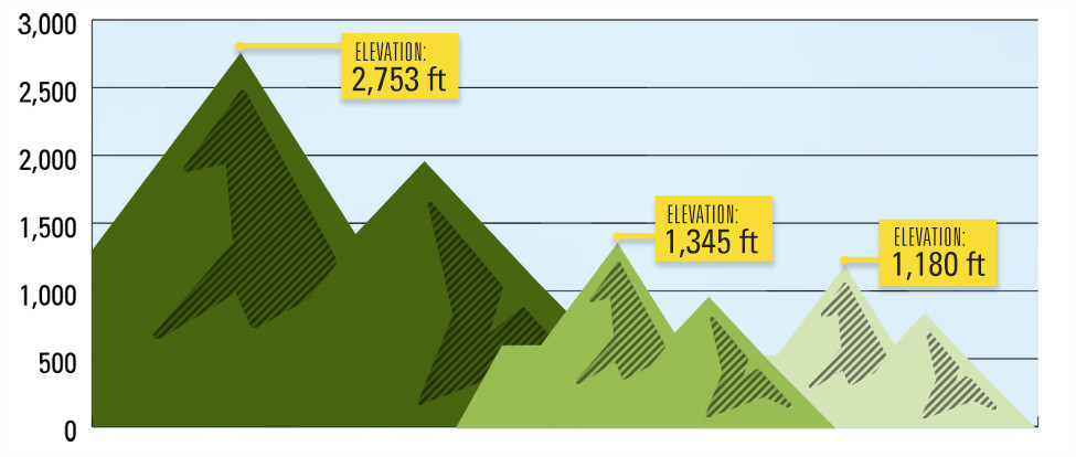
Climb Every Mountain
New heights to explore just a stone’s throw from the metro–
| Mount Magazine Distance from Little Rock: 2 hours 2 minutes |
Mount Nebo Distance from Little Rock: 1 hour 21 minutes |
Petit Jean Mountain Distance from Little Rock: 1 hour 7 minutes |
Marvel at Waterfalls
While central Arkansas may not be known for its waterfalls, northwest Arkansas certainly is. More than 30 waterfalls await hikers willing to put in the time and effort to get to these natural wonders. Some of the highlights include:
Twin Falls in Harrison
Difficulty: Easy | Distance: 1.5 miles round trip
35.78214°, -94.24263°
Glory Hole Falls outside of Fallsville
Difficulty: Moderate | Distance: 2 miles round trip
35.82210°, -93.39352°
Hemmed-in Hollow Falls in Compton
Difficulty: Strenuous | Distance: 5 miles round trip
36.07213°, -93.30753°
Cedar Falls near Morrilton
Difficulty: Moderate | Distance: 2 miles round trip
35.1214748°, -92.9337812°
#asset_cutline

